
價格:免費
更新日期:2019-06-10
檔案大小:18.8 MB
目前版本:1.1.4
版本需求:需要 iOS 10.0 或以上版本。與 iPhone、iPad 及 iPod touch 相容。
支援語言:法文, 英語, 葡萄牙文
Main Features Include:
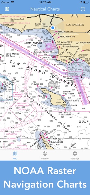
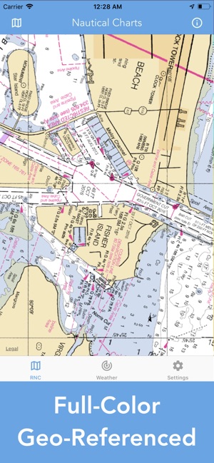
+ NOAA Raster Navigational Charts (RNC)

+ NOAA Weather Map Overlays
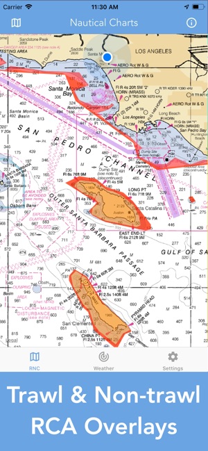
+ Trawl & Non-trawl RCA fishing overlays (West Coast)
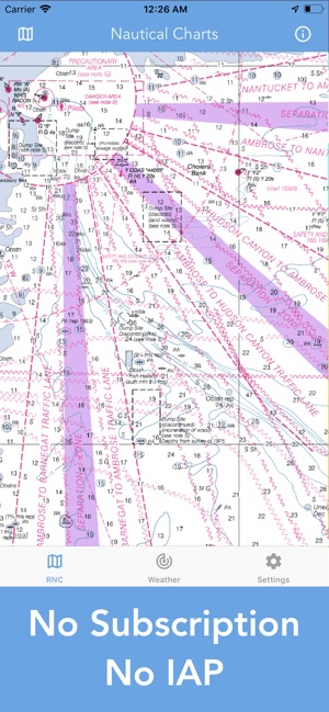
-- RNC CHARTS --
NOAA RNC charts are full-color, geo-referenced, digital images of NOAA paper nautical charts. All maps are available for download.
Weekly updates to the RNCs are done on a 'best efforts' basis. The timing of their availability is not guaranteed.
Since complete ENC coverage is available in all U.S. waters, vessels required to use ECDIS may NOT navigate with NOAA RNCs. RNCs are approved for use by IMO ECDIS mandated vessels only if adequate ENC data is not available.
NOAA RNCs DO NOT meet USCG chart carriage requirements for commercial vessels.
The NOAA RNC are intended for navigational use.

NOAA RNC are not intended to meet federal chart carriage regulations published in the Code of Federal Regulations. NOAA makes no representations that the RNC Tile Service or the RNC Tiles provided thereunder meet federal chart carriage regulations.
Users should consult the Code of Federal Regulations for current federal chart carriage requirements.
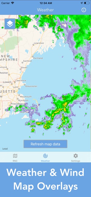
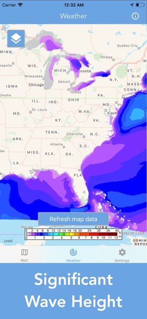
-- NOAA WEATHER DATA --
+ NEXRAD HD Radar
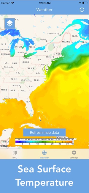
+ Sea Surface Temperature
+ Significant Wave Height
+ Wind Speed & Direction
+ Air Temperature
+ 12-Hour Rain Probability
If you have any questions, please email me at mwnbdc@gmail.com.
支援平台:iPhone, iPad